Trajectory LiDAR Data One Key Processing Software gAirHawk Point Cloud Self Developed Geosun
gAirHawk 4.9 version combines trajectory processing software (Shuttle)and lidar data processing software (gAirHawk) together.
Shuttle is a high-precision GNSS/INS positioning and attitude determination post-processing software, independently developed by Wuhan Geosun Navigation Technology Co., Ltd., built-in high precision GPS/GLONASS/Beidou II/Galileo positioning velocity measurement processor (GGPoS). The system can process multi-mode GNSS positioning velocity measurement, GNSS/INS combined positioning attitude measurement, providing centimeter-level spatial position information of motion point (or carrier), centimeter-level speed information, and thousand-degree attitude information.
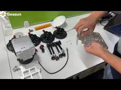
gAirHawk is a lidar scanning system acquisition monitoring and point cloud computing software self-developed by Geosun Navigation. It supports real-time configuration and monitoring of field data acquisition systems, decoding of real-time and post-process laser scanning data, calculation and display of point cloud data, supporting software for Geosun lidar scanning system.
Shuttle is a high-precision GNSS/INS positioning and attitude determination post-processing software, independently developed by Wuhan Geosun Navigation Technology Co., Ltd., built-in high precision GPS/GLONASS/Beidou II/Galileo positioning velocity measurement processor (GGPoS). The system can process multi-mode GNSS positioning velocity measurement, GNSS/INS combined positioning attitude measurement, providing centimeter-level spatial position information of motion point (or carrier), centimeter-level speed information, and thousand-degree attitude information.
gAirHawk is a lidar scanning system acquisition monitoring and point cloud computing software self-developed by Geosun Navigation. It supports real-time configuration and monitoring of field data acquisition systems, decoding of real-time and post-process laser scanning data, calculation and display of point cloud data, supporting software for Geosun lidar scanning system.
UAVLIDAR
LIDAR DATA
Trajectory
POS
POINTCLOUD
High Precision
Strip Adjustment
Opti
optimization
-

نظام المسح الضوئي LiDAR من سلسلة GAirHawk GS-1500N 8 أصداء طويلة للكشف الجوي ورسم خرائط VTOL
ﺎﺘﺼﻟ ﺍﻶﻧ -
Multi Rotor LiDAR Drone للحصول على خرائط التفتيش والمسح الأمني
ﺎﺘﺼﻟ ﺍﻶﻧ -
نظام LiDAR للطائرات بدون طيار عالي الدقة مع مجال رؤية واسع
ﺎﺘﺼﻟ ﺍﻶﻧ -
بعيد المدى 1000 متر ارتفاع طيران 1 سم دقة المحمول LiDAR Geosun GS-1350W
ﺎﺘﺼﻟ ﺍﻶﻧ -
المسح بالليزر طويل المدى VTOL UAV مركبة مدعومة بخمس نقاط ملونة خالية من السحابة من معالجة المسار
ﺎﺘﺼﻟ ﺍﻶﻧ
فيديوهات ذات علاقة